Eorimok Trail on Hallasan: The Best Non-Summit Hike on Jeju
Last Updated on October 12, 2026
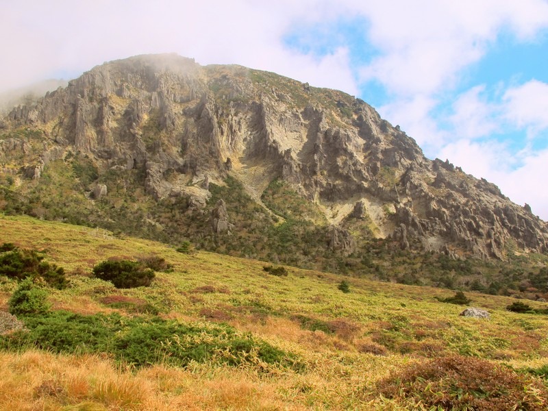
“Jeju is Mount Halla, and Mount Halla is Jeju,” as the locals say. As the tallest mountain in South Korea, a trip to Jeju Island isn’t complete without getting up onto Hallasan, whether that means the true summit or simply as far as the standard trails allow. Rising 1,950 meters, it’s visible from nearly anywhere on the island, clouds permitting. Do you need to visit Hallasan while you’re on Jeju? Yes, without question, and you should set aside a full day for it.
Eorimok Trail is, for most visitors, the best way to do that. It’s the easiest trailhead to reach from Jeju City, it requires no reservation, and it delivers some of the strongest non-summit views anywhere in Hallasan National Park, without the booking pressure and strict cutoffs that define the two trails leading to the actual crater.
Plan a trip to Hallasan Mountain:
- What To Know About Mount Hallasan
- The Trails on Hallasan Mountain
- Eorimok Trailhead and Getting There
- Eorimok Trail on Hallasan Mountain Detailed
- Do you need a guide on Mount Hallasan?
- Exit Options and Linking Trails
- When is the best season to hike on Mount Hallasan?
- What to pack for a hike on Mount Halla
- FAQ
(This page contains affiliate links. That means if you click on them and purchase something, I will get a percentage of the transaction at no cost to you. Thanks for the support!)
What To Know About Mount Hallasan
Hallasan stands 1,950 meters tall, the highest point in South Korea, visible from virtually anywhere on Jeju. You may also hear it called Yeongjusan, an older name meaning roughly “mountain high enough to pull down the galaxy.” Korean folklore around this mountain runs deep, and once you’re standing on it, it’s not hard to understand why.
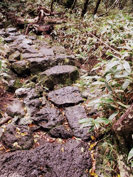
The mountain’s volcanic geology creates a genuinely unique ecosystem, with dramatic, shifting terrain as you climb. At the summit sits Baengnokdam, a crater lake 108 meters deep and 550 meters wide, formed by an eruption thousands of years ago. In 2007, “Jeju Volcanic Island and Lava Tubes” became Korea’s first UNESCO World Natural Heritage Site, Hallasan included.
Renting a car makes reaching the various trailheads significantly easier. Public transportation on Jeju works, but wait times between buses can be long, and Hallasan’s five trailheads sit on entirely different sides of the mountain with no roads connecting them directly. A car maximizes the time you have on the island, though the bus system, detailed below, is entirely workable if you’d rather not drive.
There’s no camping permitted anywhere on the mountain, and no overnight stays inside the park, you need to complete your hike within park operating hours. Hallasan National Park opens at 5:00am from May through August and 6:00am from September through April, closing around 6:00pm.
The Trails on Hallasan Mountain
There are five hiking trails on Hallasan Mountain and some hiking enthusiasts will go back again and again to hike them all or hike every season because it’s beautiful and different in every season. You should note that there is no camping on the mountain. Make sure you know the opening and closing hours of the Hallasan National Park because you cannot stay overnight. You need to finish your hike within the day.
- Gwaneumsa Trail: 8.7 km
- This trail on the northern side of the mountain goes all the way to the summit.
- Takes about 10-12 hours in total
- There’s a campsite at the trail entrance for this trek if you want to get the earliest start you can, spend the night there before.
- Gwaneumsa Trail requires a reservation. It can be closed due to inclement weather at the top.
- Seongpanak Trail: 9.6 km
- This trail is on the eastern side of the mountain and goes all the way to the summit.
- Though the longest trail, it takes about 9-11 hours in total.
- This trail can be a bit treacherous so it’s not recommended to do this trail on your own.
- Seongpanak Trail requires a reservation. It can be closed due to inclement weather at the top.
- Eorimok Trail: 4.7 km
- This trail only goes to the midway point.
- This trail takes about 6-8 hours in total.
- This trail takes you to Witsae Oreum and Nambyeok which are prone to severe and quick weather changes including fog and lightning so stay vigilant about checking the weather.
- Yeongsil Trail: 3.7 km
- This trail only goes to the midway point.
- This trail takes about 6-7 hours in total.
- Deonnaeko Trail: 9.1 km
- This trail only goes to the midway point.
- This trail takes you to Witsae Oreum and Nambyeok which are prone to severe and quick weather changes including fog and lightning so stay vigilant about checking the weather
For everyone’s safety, there are rangers on the mountain and if you don’t reach certain points early enough in the day, they won’t let you continue as they know you won’t be able to make it back to the bottom by night fall so be aware and respectful of their guidance. Hallasan National Park opens at 5:00am from May through August and 6:00am from September through April. If you don’t reach the uppermost shelters by certain times, you’ll be turned away later in the day and told you won’t be able to make it to the top. As nightfall comes later in the summer months, you can hike up to these points the latest in the summer.
To ensure you have enough time, in the winter months, you should plan on getting on the mountain by 9:00am at the latest. In the summer months, you can get on the mountain by 10:00am at the latest. And in the spring and fall, you should get on the mountain by no later than 9:30am.
Eorimok Trailhead and Getting There
Eorimok Trail starts at the Eorimok Visitor Center on the northwestern side of Hallasan National Park, about a 25-minute drive from Jeju City.
Entry timing: No reservation is required for Eorimok. Last entry is typically around 11:30am in winter and around 12:30pm in other seasons, though exact cutoffs shift by month, check the current schedule before you go. As a general guideline: aim to be on the trail by 9:00am in winter, 9:30am in spring and fall, and you have a bit more flexibility, up to around 10:00am, in summer when daylight runs longer.
By bus: Take bus 240 from Jeju Intercity Bus Terminal or Jeju International Convention Center toward the 1100 Altitude Rest Area, getting off at the Eorimok Entrance stop. The ride runs roughly 35-50 minutes depending on your starting point. From the bus stop, it’s a 10-20 minute walk to the actual trailhead and visitor center, the path is paved the whole way. Weekend variant routes 1100 and 1100-1 also serve this stop.
By car: There’s a proper car park directly at the trailhead. It fills quickly during peak autumn foliage season and on clear weekends, arriving before 7:00am is the safer bet if you’re driving yourself.
Lockers: The visitor rest area, in the building just past the car park barrier, has free lockers, genuinely useful if you’re carrying a full pack for a longer Jeju trip and want to hike unencumbered.
Facilities: Restrooms and a small rest area are available near the trailhead, with a water tap shortly after the start of the climb and another near Witseoreum Shelter. Carry enough to reach them, but you won’t need to carry your full water supply the whole way.
Eorimok Trail on Hallasan Mountain Detailed
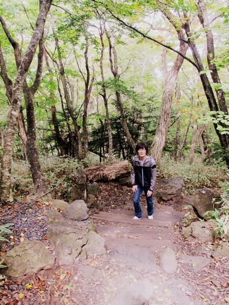
At the start of our trip, we headed toward the Yeongsil Trail. On the southwest of the mountain, this trail is the shortest and so, as we realized, is quite popular with the tourists looking to get a half days hike in. The cars wrapped around down the street, and though we were just in front of the parking ticket booth, the attendant told us that the cars wrapped around for quite some time and we’d be waiting awhile. He directed us to head just around the bend to Eorimok Trail on the northwest side of the mountain if we wanted to jump right into the hike and still be able to finish in time.
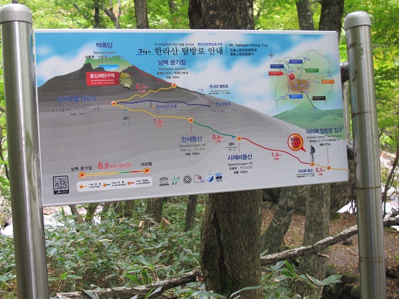
This trail is short and relatively easy for beginners, we were told. I hike at least once a month as most of my readers may be able to tell by my posts about hiking with the teachers, but my husband does not. He came to the mountain in jeans and sneakers if that says anything, though he wasn’t the worst by far.
We saw a girl with a skirt and flip flops on and countless tourists in dresses making their way up the mountain. I do not suggest this to anyone going up this trail, it’s not that easy though it is the chosen course for families with people ranging from young children to the elderly as we found out.
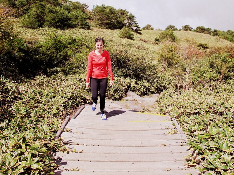
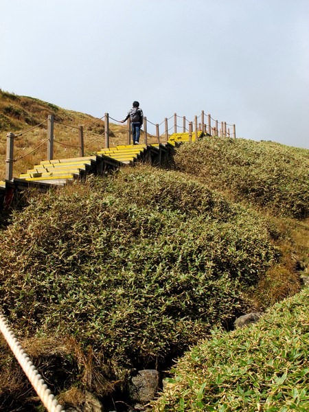
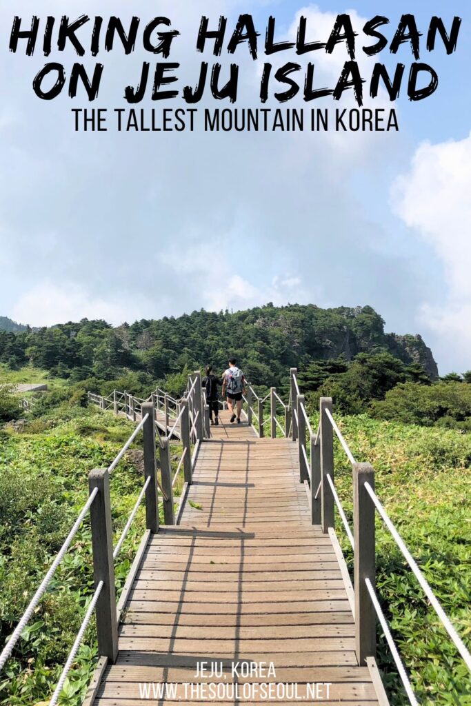
Signs every couple of kilometers let hikers know how far they’d come, which areas were the most difficult, and which areas to look forward to. It was great way to get people to pace themselves. The first hour of the Eorimok trail was the most strenuous, as the signs had led us to believe would be so, but once up and out of the lush forest a wooden platform path with a slight incline wrapped the rest of the way up the treeless slope. Yeongsil trail and Eorimok trail met up at Witseoreum.
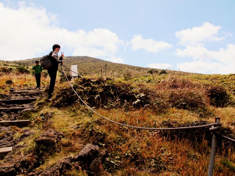
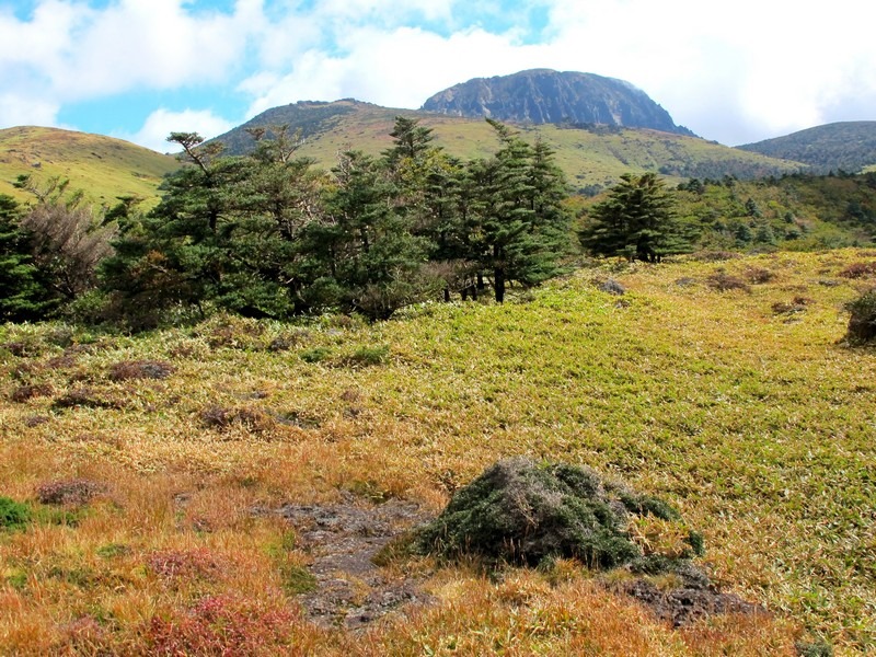
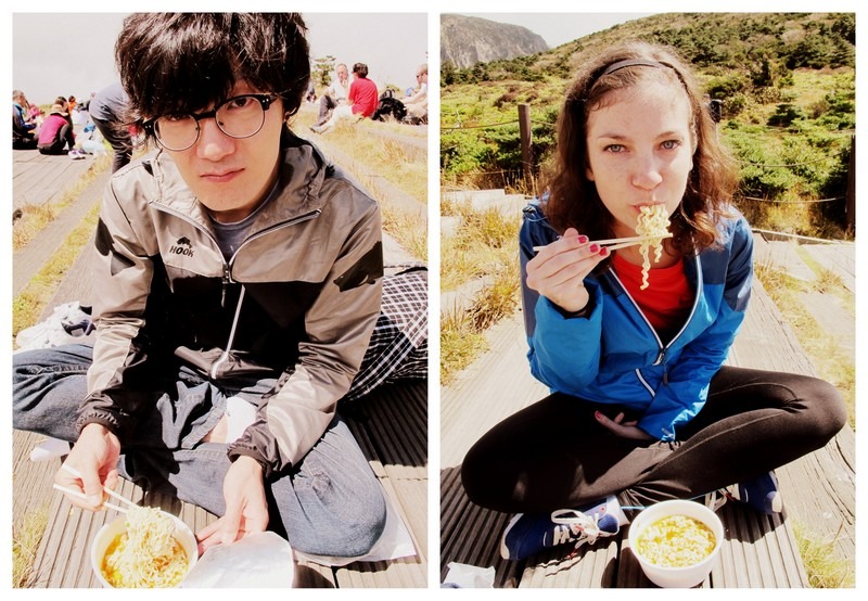
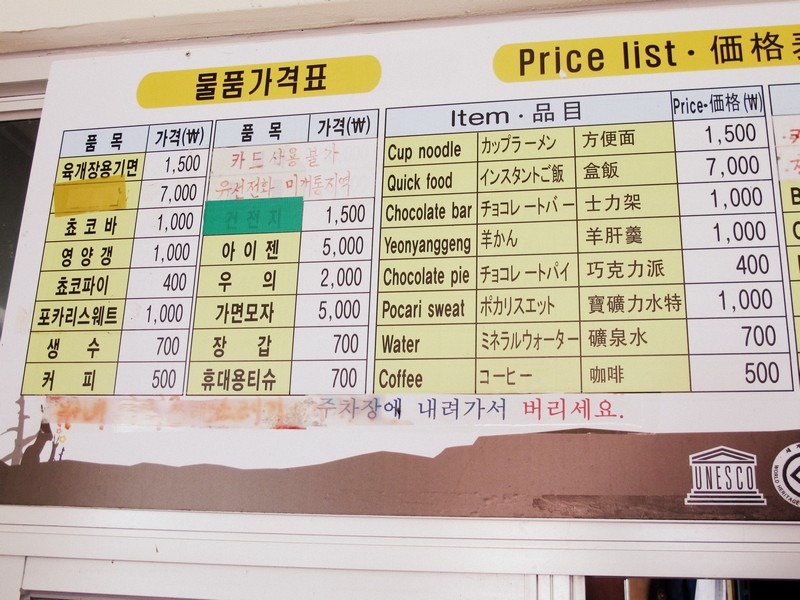
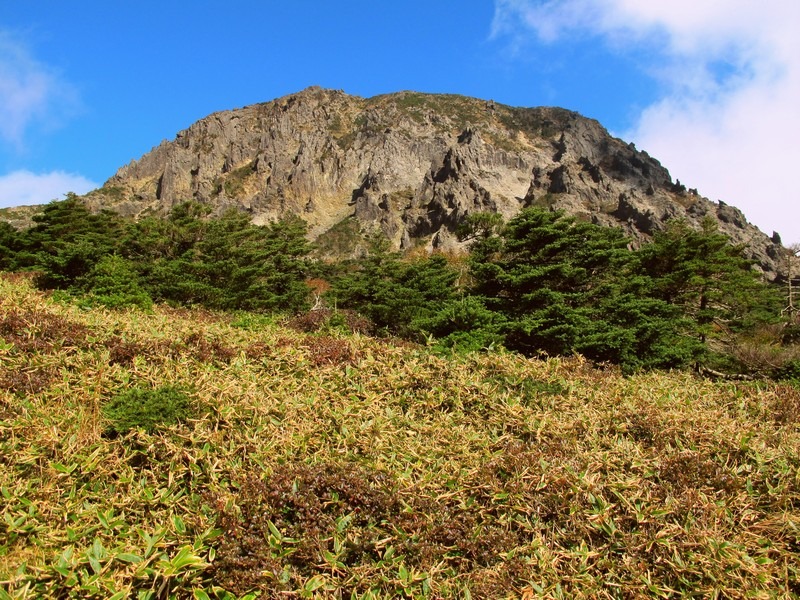
Here hikers rested and had their fill of ramen and coffee and chocolate bars. At this point there was a choice to be made. We opted to hike even further toward Mount Halla to South Wall Fork, even though we could see the peak of Mt. Halla clearly from here.
Getting to the peak is what I’d hoped for, but unfortunately the trail from this side had been marked restricted to allow years of hikers’ foot prints to be taken over once again by the mountain. Not many hikers continued on from Witseoreum, instead they went down Yoeongsil trail or just turned around.
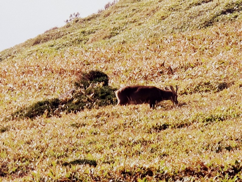
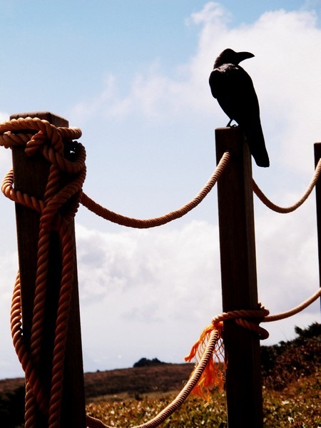
The path was quiet past the rest stop and overgrown in some areas. It was so quiet in fact that a young deer came out of hiding and stood quite close to where we stood. Crows squawked all around Witseoreum, leaving a very eerie impression on me, but once we’d made it out of eyesight of the rest stop, the crows’ sounds ceased and a calm serenity could be found.
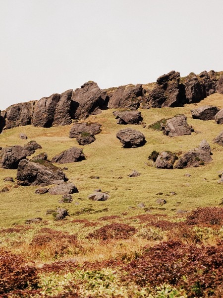
We met only a few other hikers along the path and took the time to enjoy the view of the mountain, of the oceans below and of the meadows surrounding us. It was truly breathtaking. Nature always has a way of dazzling me.
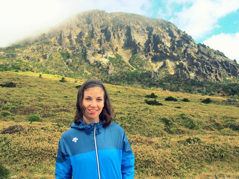
In total, Eorimok to Witseoreum was 4.7 kilometers and from there to South Wall Fork was another 2.1 kilometers. By the time we made it back down the mountain, exhausted and in need of immediate full body massages we had hiked 13.6 kilometers up and down. It was well worth it and the full body massages we received afterward were well deserved. Next time, I want to hike a trail that will allow me to get all the way to top!
Do you need a guide on Mount Hallasan?
To be honest, you really don’t. The routes are very well detailed and there are signboards posted throughout the trail so you can easily see how far you’ve come and how far you still have yet to go. If you’re not used to hiking or want assistance, you definitely can take a guide, but by and large, most people are just hiking on their own at their leisure.
Exit Options and Linking Trails
From Witseoreum, you have several choices:
Turn around and retrace your steps back down Eorimok, the simplest option and a complete, satisfying hike on its own.
Descend via Yeongsil Trail on the western side instead, which has stronger bus connections and means you’re not walking the same terrain twice. This is the move if you don’t have a car waiting at the Eorimok trailhead specifically.
Continue south and link with Donnaeko Trail if you have the legs and time for it, transforming the day into a full north-to-south crossing of the mountain. This is significantly more committing, both in distance and in transport logistics (you’ll end up on the opposite side of the island from where you started), but it’s widely considered one of the most rewarding ways to experience Hallasan without going for the true summit.
If you’re not driving, descending via Yeongsil is generally the most practical choice for getting back to Jeju City efficiently.
When is the best season to hike on Mount Hallasan?
Most people recommend hiking in the spring and autumn when the breezes are cool and the sun shines brightly. The winter can be beautiful with everything covered in snow and it is one of those hikes that Korean hiking clubs will plan last minute if they hear a snow storm has fluffed everything up, but unless you’re an experienced hiker, I wouldn’t recommend that.
The summer months in Korea are also dreadfully hot and humid and there’s isn’t much coverage at all once you get through the first forested area of the trails so if summer is the only time you can go, pack a ton of water.
We went in the autumn which was really ideal. We needed a light jacket when we got higher up, but overall it was comfortable temperature wise and we weren’t too hot or cool and still had plenty of flora and fauna to see.
What to pack for a hike on Mount Halla
Generally, you can pack light for a hike on Mount Hallasan and should include:
- Breathable sportswear for clothing
- A jacket for when you get higher up
- Hat, sunglasses, and sun cream are a must
- Insect repellant
- Plenty of water
- Some snacks
- More challenging routes (Not Eorimok Trail or Yeongsil Trail) require more hiking gear and climbing equipment especially in the winter.
FAQ
Do I need a reservation to hike Eorimok Trail?
No. Reservations are only required for the two summit trails, Gwaneumsa and Seongpanak. Eorimok and Yeongsil, the two trails leading to Witseoreum Shelter on the plateau, require no advance booking.
Does Eorimok Trail reach the summit of Hallasan?
No. Eorimok ends at Witseoreum Shelter on the plateau, below the true summit and crater lake (Baengnokdam). Only Gwaneumsa and Seongpanak reach the summit itself, and both require reservations.
How long does Eorimok Trail take?
Plan for 3-5 hours round trip to Witseoreum and back, depending on pace and how long you stop along the way. Linking with Yeongsil or Donnaeko extends the day significantly.
How do I get to Eorimok Trail from Jeju City?
Take bus 240 toward the 1100 Altitude Rest Area and get off at the Eorimok Entrance stop, then walk 10-20 minutes to the trailhead. By car, it’s roughly a 25-minute drive from Jeju City.
Is Eorimok Trail difficult?
It’s rated moderate, manageable for most hikers in reasonable shape. The first hour through forest is the most physically demanding section; the plateau beyond is comparatively flat and easy going.
What’s the best time of year to hike Eorimok Trail?
Spring and autumn offer the most comfortable temperatures and clearest views. Summer is hot and exposed once past the treeline; winter is beautiful but requires proper gear and experience.
Can beginners hike Eorimok Trail?
Yes, it’s one of the more beginner-friendly options on Hallasan, alongside Yeongsil. That said, proper footwear and basic hiking fitness still matter, this isn’t a casual stroll despite the engineered, boardwalk-heavy terrain.
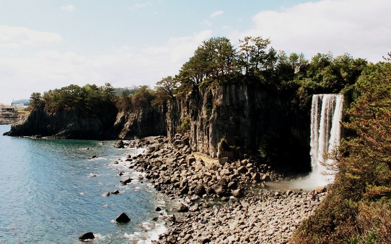
There are amazing things to see on Jeju Island and hiking up Mt. Halla is just one of them! If you need some seaside fun after you hike, don’t miss the gorgeous Hamdeok Beach before you leave Jeju Island. You should also check out the epic Jeongbang Waterfall, Sanbang Grotto and the beautiful Yakcheonsa Temple.
Did you like this post? Pin It!

2 Comments
Jamila
How long did it take to use this route: Eorimok Trail going up and Yeongsil Trail going down? can this be done in half a day?
Hallie
It took us pretty much the whole day to go up and come down but we aren’t avid hikers so we took our time. We didn’t start that early either. I think we started around 10:00AM and ended up getting down around 4:00PM. If your goal is to shoot for half day, just start earlier and it can be done I’m sure.